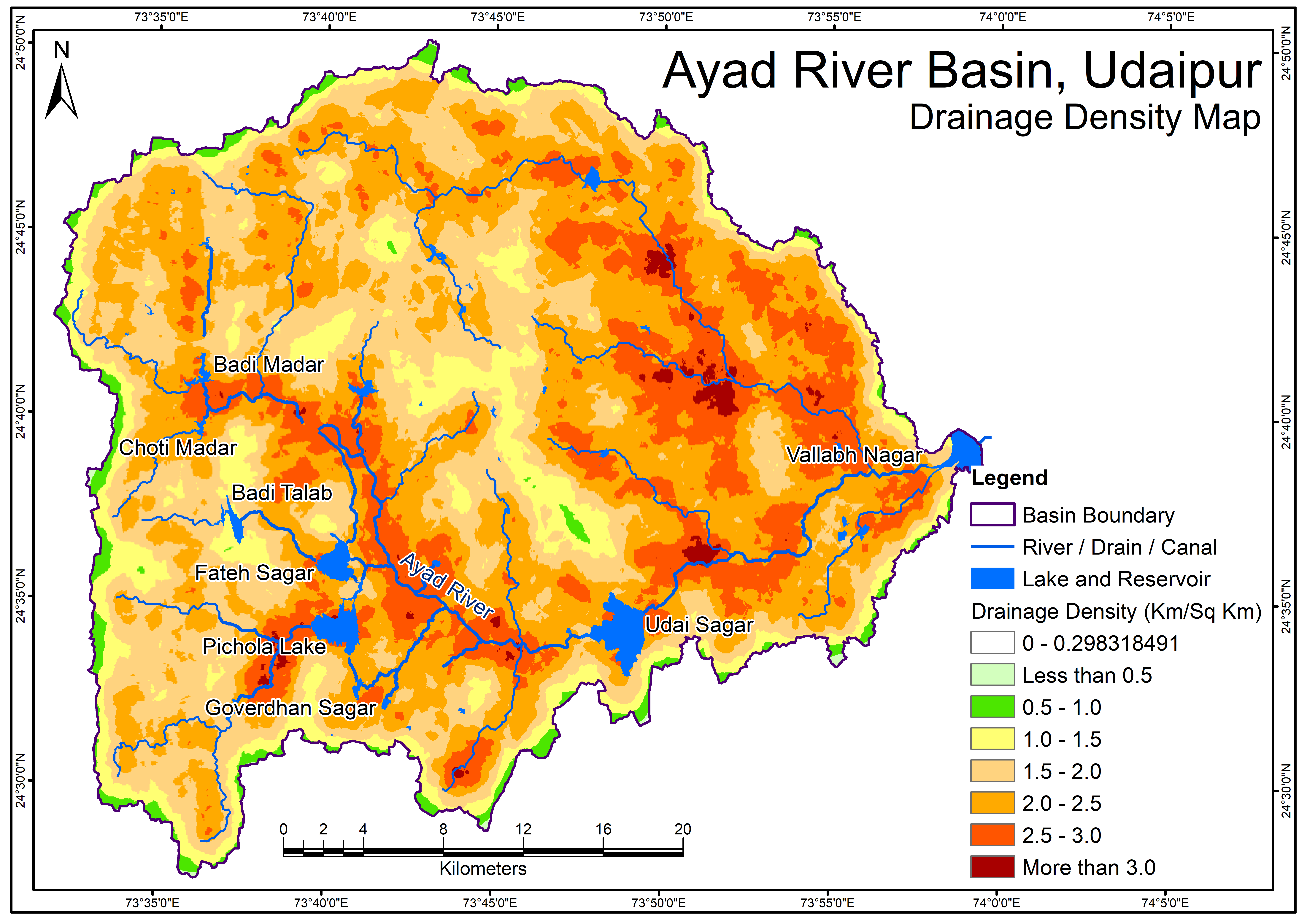
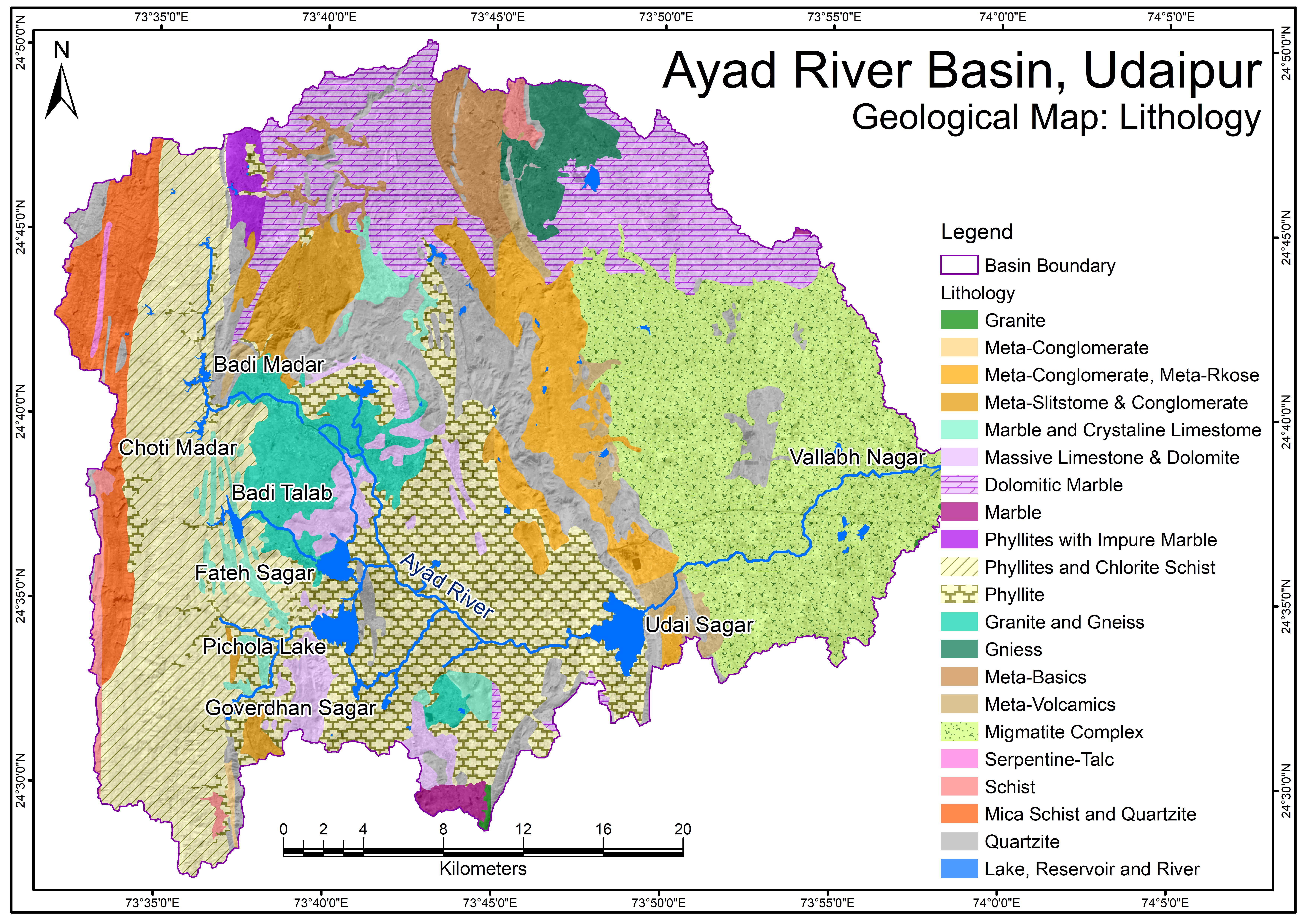
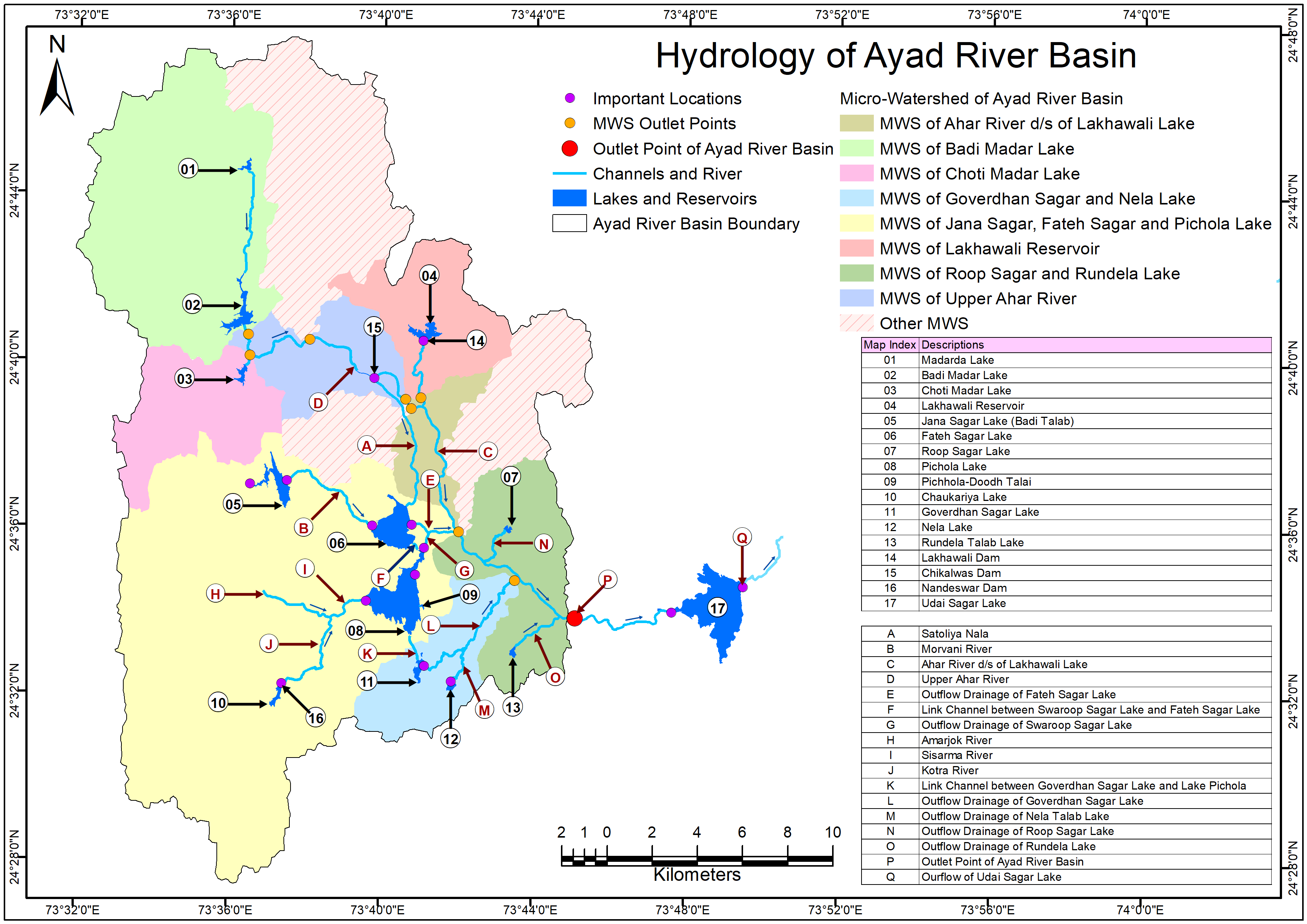
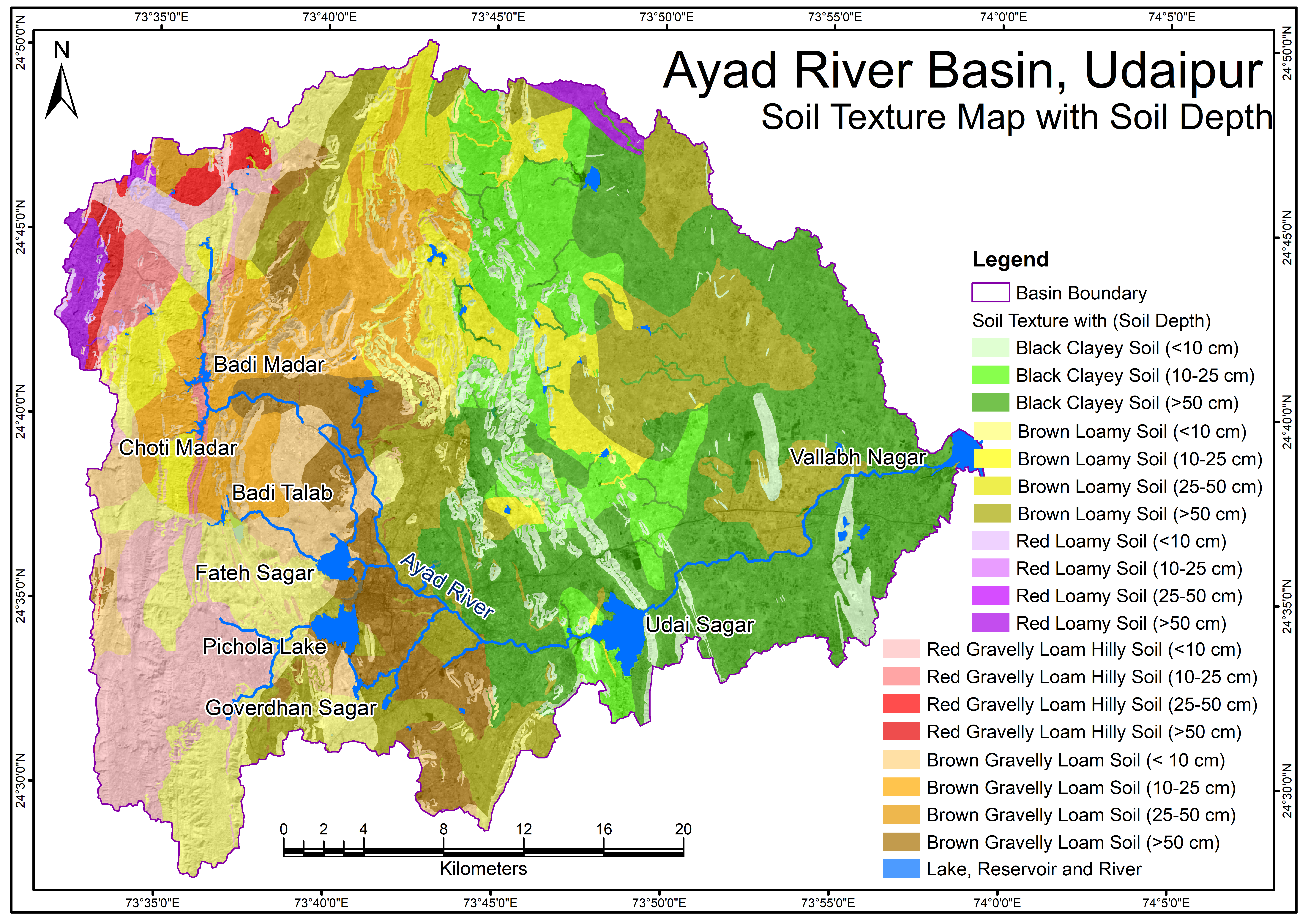
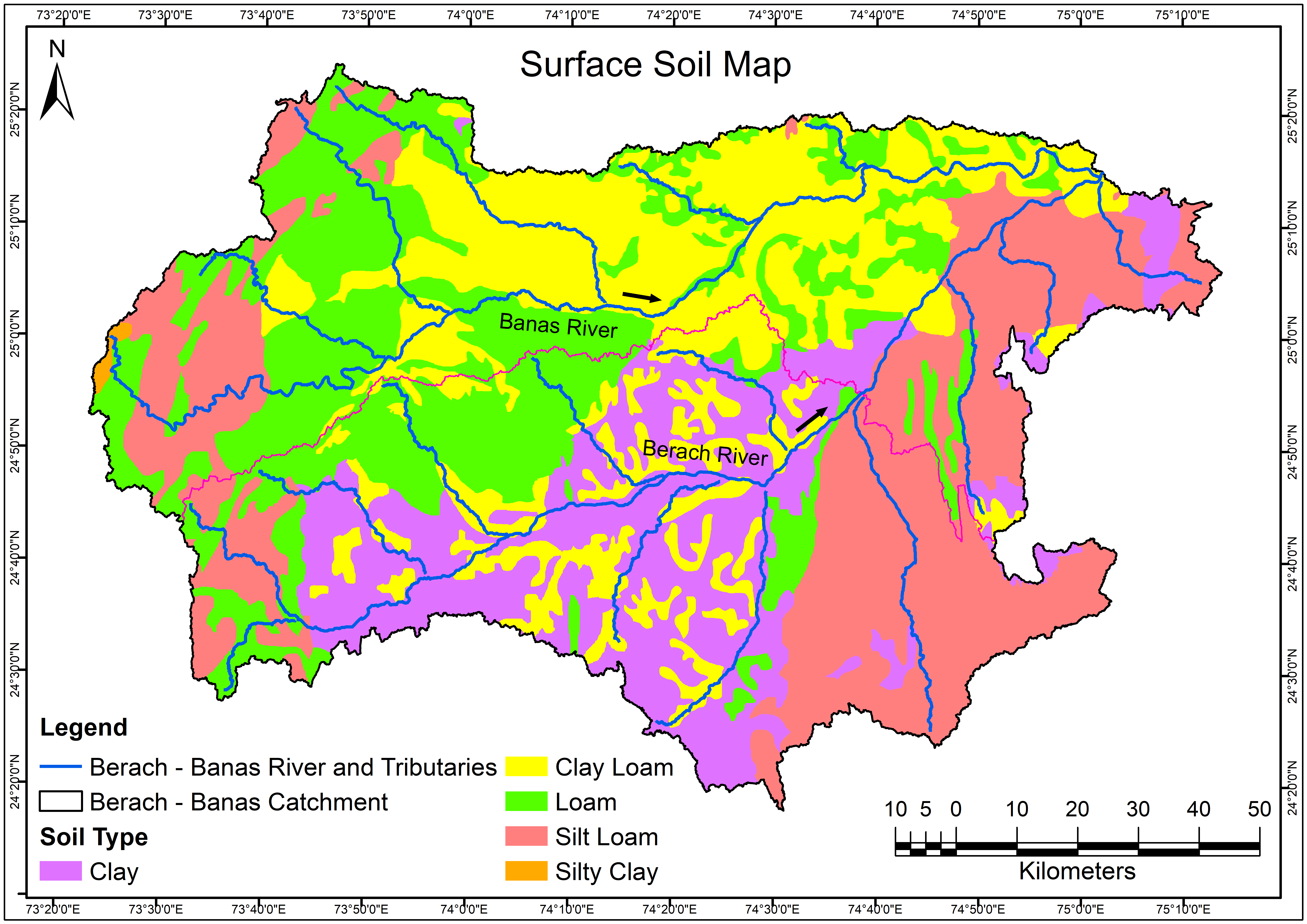
Drainage density is a quantity used to describe physical parameters of a drainage basin. Drainage density is the stream length per unit area. Drainage density depends upon both climate and physical characteristics of the drainage basin.
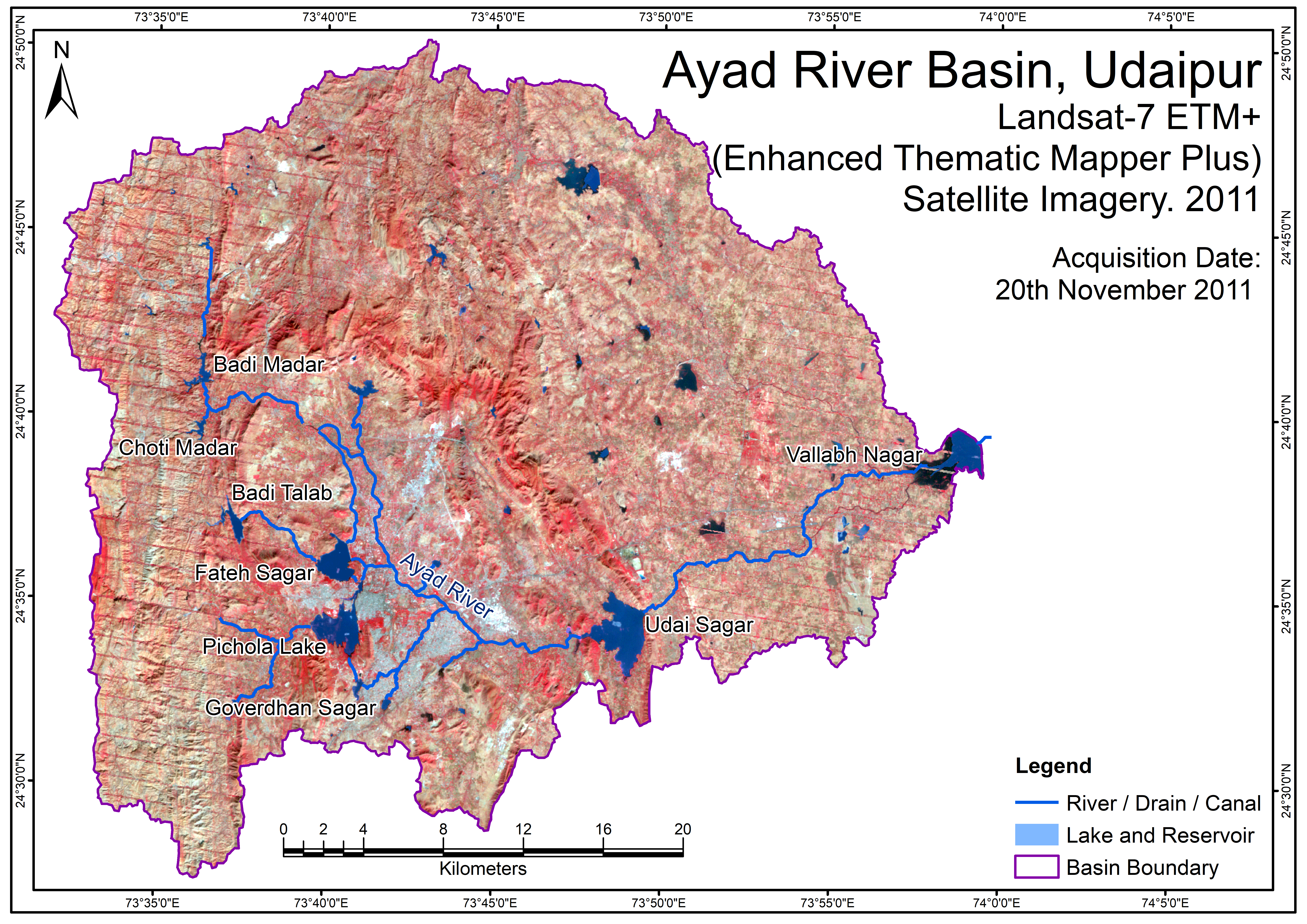
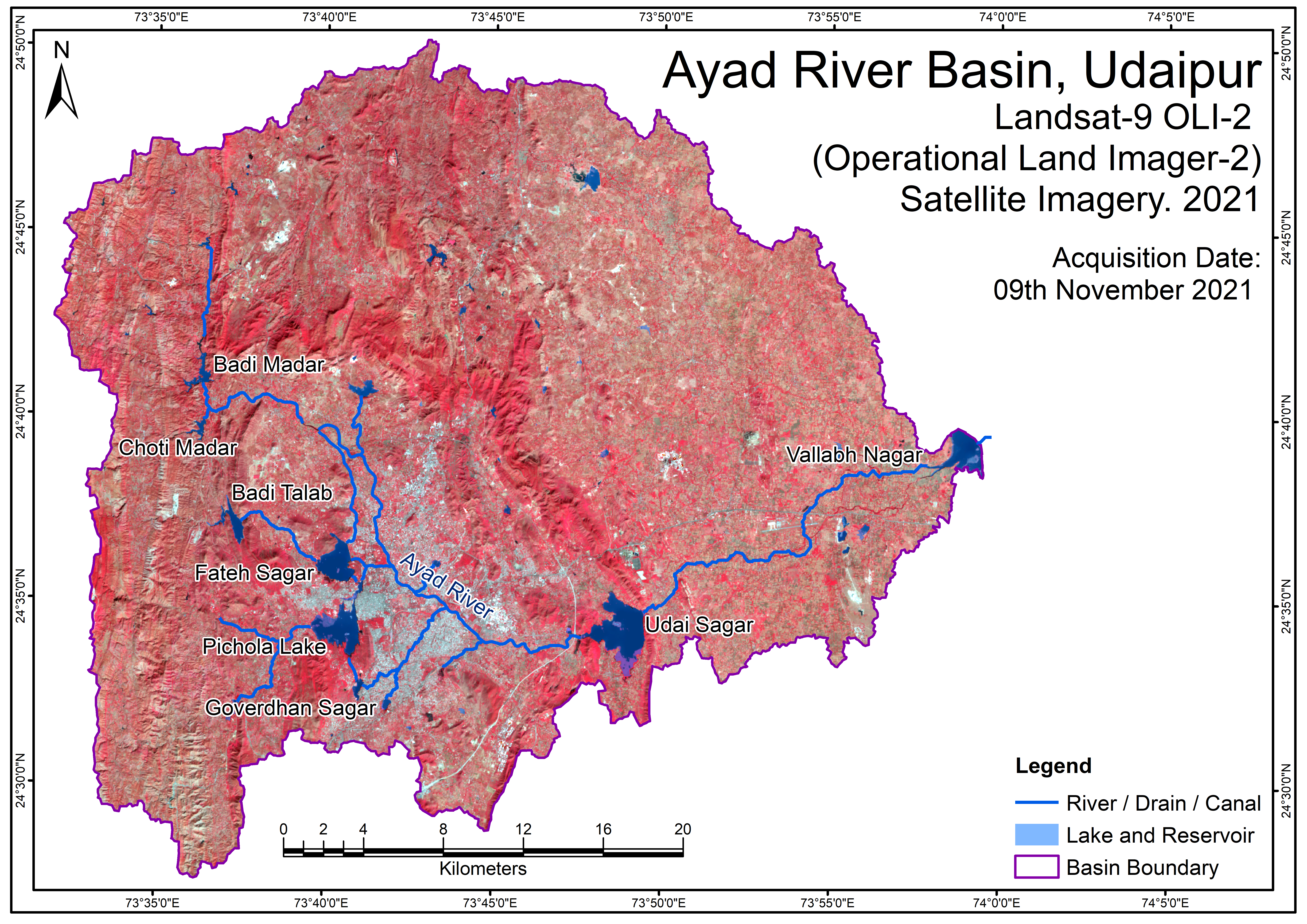
Source: Drainage density has calculated by using drainage network GIS layers, which extracted from SRTM DEM data with 30 m spatial resolution by using Spatial Analyst Tool in ArcGIS-10x software.
 Map.png)